The ‘Heat Planning and Decarbonisation of Heating Networks Act ’1 came into force in Germany on 1 January 2024. The aim of this law is to achieve climate neutrality in heating networks by 2045. The law stipulates that binding heat planning must be implemented in all municipalities with fewer than 100,000 inhabitants by 30 June 2028. Achieving climate neutrality in heating networks requires detailed knowledge of the current demand situation, particularly when planning new supply structures with a high proportion of renewable energies. This data is often missing, is not of standardised quality, is not geo-referenced or is not provided by the stakeholders involved. Obtaining data is particularly challenging in rural areas, as in small towns with fewer than 20,000 inhabitants there is either no data or only limited data available.
To analyse the data, a heat and an electrical energy atlas will be compiled and combined in the energy atlas. The aim is not only to analyse municipal heat planning but also to take into account and integrate the electrical demand analysis.
Sources for this are freely accessible databases and Open Street View maps. For the energy atlas, energy characteristics are assigned to each building, enabling a localised resolution.
The following is an example of the heat atlas developed for the Wittichenau cell.
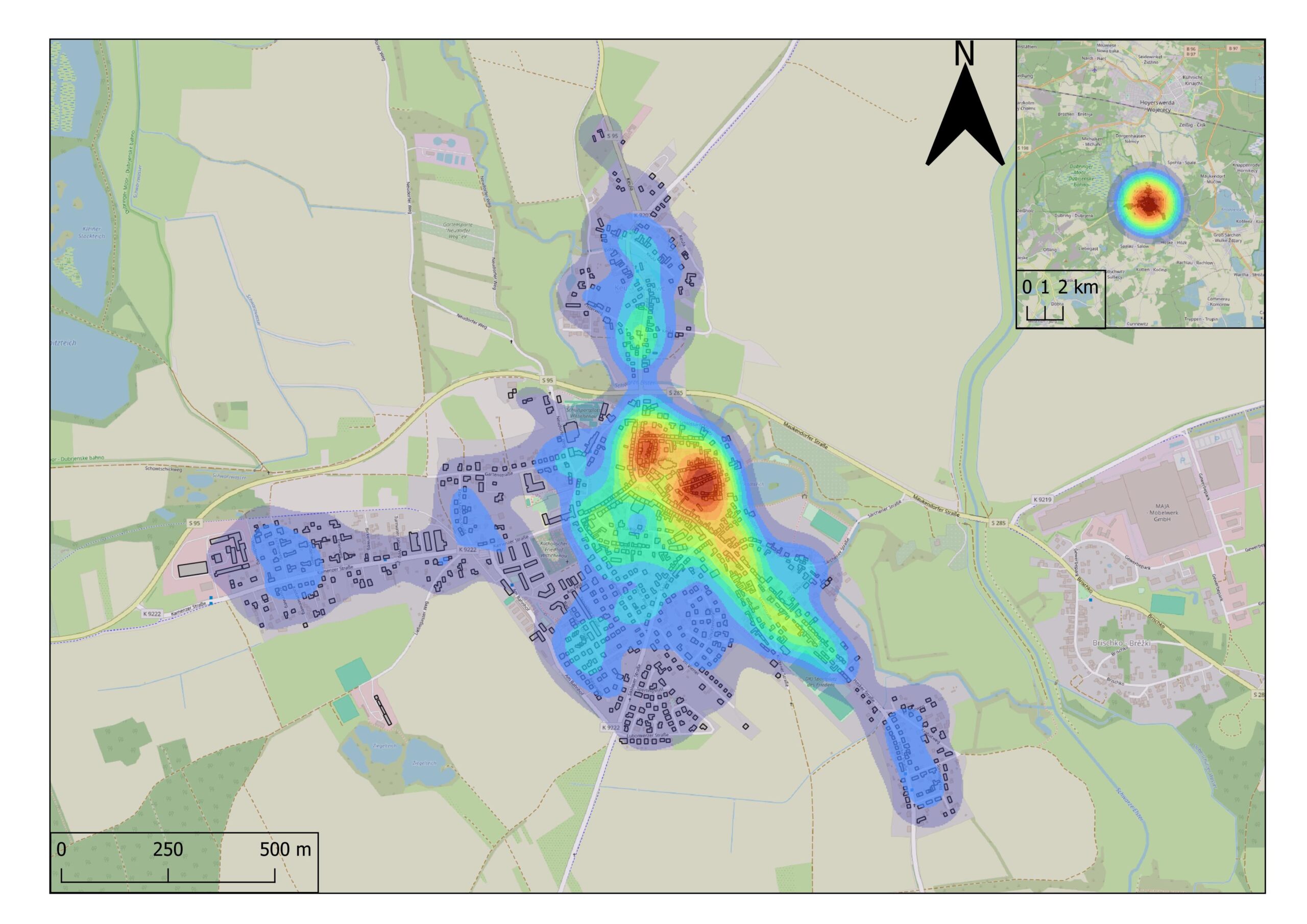
As a result, a total of 1,176 buildings were recorded, analysed and classified in the heat atlas for Wittichenau, i.e. for the town centre of Wittichenau and the district of Keula.
In a second step, the potential of renewable energies in the region is analysed. The subject is the installation of PV systems, wind turbines, biomass-based systems and hydropower. In addition, comprehensive research is carried out into the demographic and economic development of the region. All data is processed in three different future scenarios.